

CONTRIBUTED BY STEVEN SABLAN

Kohgoh Sekirinzan (also known as Asumui) is located in the mountains at the very northern tip of the island.

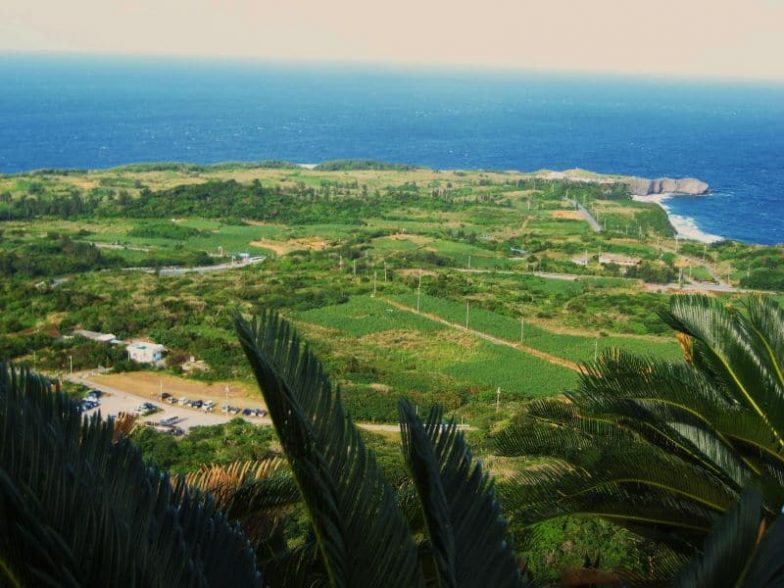
If you’re standing on Hedo Point looking out to the ocean, do an about face and look up to the mountains – that’s Asamui.

Asumui is an Utaki, or ancient Okinawan prayer site. The place is notable not only for its stunning views of the surrounding area below, but also for the incredible rock formations that date back over 200 million years.

It is widely considered to be the geologically oldest place on the island – quite literally, the birthplace of Okinawa. For centuries this collection of mysterious rock formations was one of the most important worship sites for priests, priestesses, and Ryukyan kings.
One look at these formations and one can understand why the ancients considered Asumui to be the home of the gods. In more recent years, the land was purchased by a private company and turned into a tourist attraction. For about $15, you can purchase a ticket and board a bus from the parking lot at the base of the site to the start point of the walking tours. You can pick up an English language pamphlet with information of each route where you buy your tickets. If you have a fear of heights or unsure footing, I recommend you think twice before visiting Asamui.
There are four self-guided walking tours. One path is designed specifically for the wheelchair-bound or those with trouble walking and consists of a wide, well maintained boardwalk. The other three, though, cut through the rocks and look as if they are they same paths the ancient shamans used 25 centuries ago. Some of them have ropes at points to help you steady your footing. The other adventure is the bus ride from the parking lot to the trailhead. The “road” is unimproved, narrow, and extremely bumpy. If you’re up to it, though, I highly recommend Asamui. It’s uniquely Okinawan and an experience you’re not likely to forget.

Kohgoh Sekirinzan Park
Address: Japan, 〒905-1422, 沖縄県国頭郡国頭村字宜名真1242−1
GPS Coordinates: 26.8458752, 128.25529419999998
Directions: Point your car north on Route 58, and go as far as you can in that direction to get to Kohgoh Sekirinzan Park. Driving to Hedo Point on route 58 from the west side of the island, when you get to the intersection where you would take a left to go to Hedo, take a right and follow the signs.