CONTRIBUTED BY QUENTIN RICHARDSON

Urasoe Pano 1
Urasoe City Park & Castle Site is a massive network of observatories, walking paths and a large playground at its lower level. The park sits on a high hill on the border of Ginowan & Urasoe. It branches out in several directions and also includes nearby neighborhoods, cemetaries and a large athletic park.

Urasoe Castle
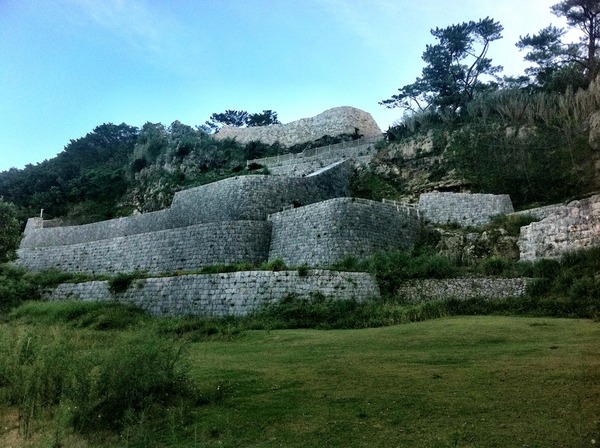
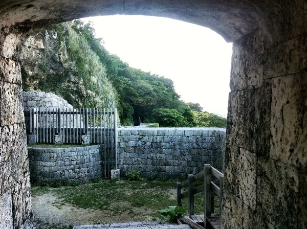
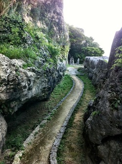
For a shutterbug, the park offers outstanding views from the observatories and very interesting shots of the historical sites. On the clearest of days, you can see parts of Shuri Castle, the Keramas, the Futenma Airstrip and other major landmarks in the Ginowan region. You can get easily viewable cityscapes from most of the park. The area around the lower levels also have a “castle like” appearance as well. If you like castle ruins as much as I do, the site here is comparable to Katsuren.

Urasoe Pano 2
The park is very family friendly. You can watch softball games on the southern end of the park since it is connected to the Urasoe Athletics Park. You can jog along the trails leading you from one end to the other (bring water!) or watch the kids play at the renovated playground at the lower level. There are plenty of shaded places to enjoy a pinic, and a small food shop sits inside the observatory at the summit. Okinawans come to this park to relax and take breaks around mid-day.

Urasoe Hall
I navigated through most of the park in under 2 hours (remember, massive network) and took shots with my iPhone. There are a lot of mosquitoes in the shaded areas so bring spray, and the sun penetrates through most of the park so protect yourself. Getting around the park requires a lot of walking, to include up/down steps, so wear comfortable shoes. The park has multiple parking areas and has the typical from dusk to dawn hours.

Urasoe Vert
Directions: The park can easily be seen on the left traveling north on Pref. Highway 330 a minute after passing the Nishihara IC and before the tunnel. However, the park is big and some parts of the park you will need to drive to instead of walk (unless you want to). From Kadena Gate 2 you can get there by taking a right turn on to 330. This is the slow way since 330 is very busy. Continue north past the Urasoe Athletics Park until you see the exit for Route 38 and turn left on to Route 38. Follow the signs for Urasoe Park which leads to another left turn on to Route 153. The first signpost leads you to a cream colored road through a neighborhood to the Castle Site (at the very end of the road). The second signpost marked “Observatory Gate” leads you to the top where you see 2 observatories, one containing the food shop. Even further down leads you to the lower level where the playground is located.

Urasoe Sign
Alternatively, I used the Expressway and exited off the Nishihara IC. Turn left on to Route 330 and remain in the left lane. You will follow this road for about 10 minutes reaching Route 38. Get in the far left lane and turn left on to 38. Much faster huh? If you are on Foster or Kinser, use Route 58 and travel east on Route 153, Makinminato Intersection (not the light with the pedestrian overpass or the Bypass Route). The park begins at the intersection just past Route 251 (Pipe Line Dori), look for the brown stone sign. Continue up Route 153 until you see the signposts in reverse order of the Kadena directions.


Just a tip to make it a little easier for those traveling by route 58: The signage for route 153 isn’t great going south on 58. Route 153 is the street that Arin Krin a.k.a. the Garlic House is on. So if you know where that restaurant is, turn left there.
Nishihara is exit 2. Stay to the left after the toll booth.
Which # is the exit for nishihara? I live between Courney and Kadena gate 3, and I’m just trying to figure out how to get there.
FYI: Ginowan and Urasoe Cities are SOUTH of KAB. 🙂
Great post, Q, thanks!
I’m taking the family. (Great picts too!)
What camera is used to take these pictures?
An iPhone 4 or greater, then edit them with iPhoto… For panoramic shots, I used the AutoStitch app.