


CONTRIBUTED BY QUENTIN RICHARDSON
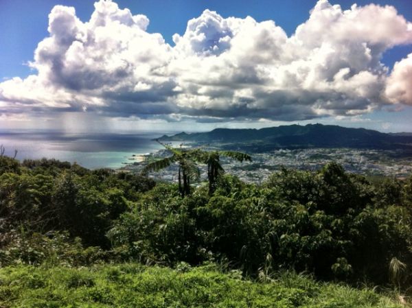
Nago Mt View 1
After reading about it and finally having a day nice enough for it, I decided to take a trip up Nago Mountain. What’s really cool about this mountain besides the view and the satisfaction of a good workout, is that is has more than one way to climb to the top.
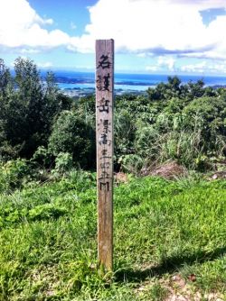
Nago Mt Marker

However you approach Nago Mountain, you have to start from the upper levels of the beautiful and scenic Nago Central Park. You have the option of driving up to the observation decks or parking below and warming up by walking to them. The south entrance, near the Orion Beer Factory, will force you to walk due to some repair work along the road. Use the north entrance if you plan on driving to the trail entrance.
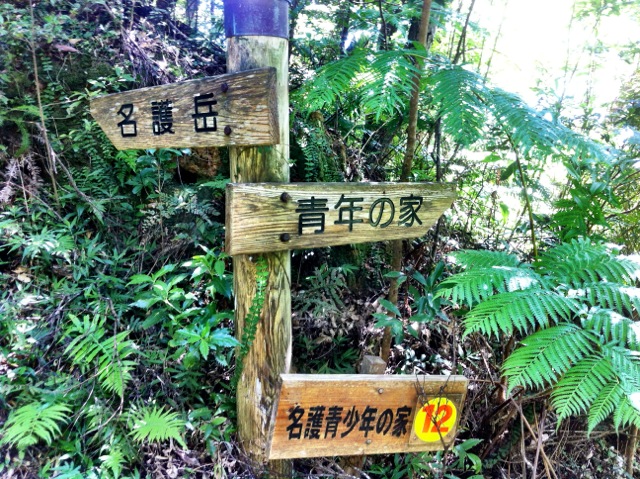
One way to enter the trail (the less noticeable) is located at the lower observation point. It is at the end of a what looks like a cricket field. At the start of the trail, you will see a sculpture of a foot and signs in Japanese pointing you towards the trail. The number you need to reference is either 11 or 13 (you’ll know what the numbers mean later).
The easier, yet riskier way to enter the trail is at the end of the Youth Summer Camp. There is a larger greenish multi-story building next to a large flat field, following the road and crossing another smaller field leads you to the beginning of the trail. Since I had a backpack and was quiet, and respectful, they let me pass by. The place is full of young kids camping who find it very amusing to exchange greetings in English. If you present the image of a harmless hiker and exchange friendly greetings, they let you pass by. There is a sign indicating that the area is private property.

Nago Mt Looking Up
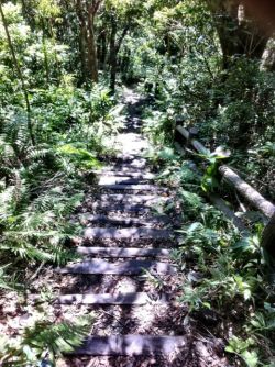
Nago Mt Stairs

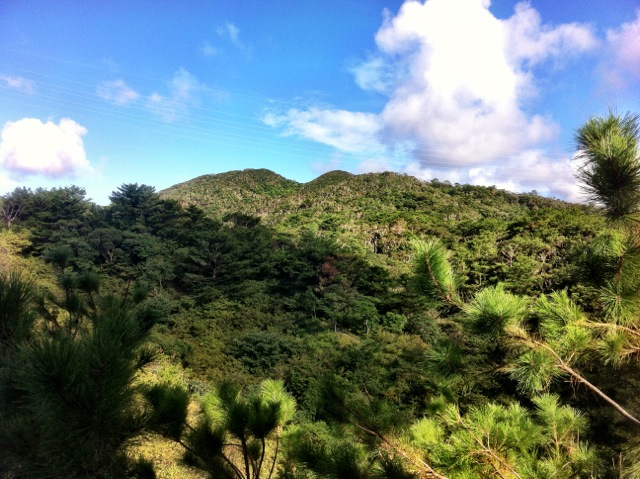
Upon reaching the trail, either way you enter, you may see kids and their guides marching back, which in my mind, meant easy hike. Wrong! The trail from the youth camp begins over narrow cuts in the hills as you walk over sandbags covered in clay. It later levels out and then extends deep into the woods up and down series of steep stairs.
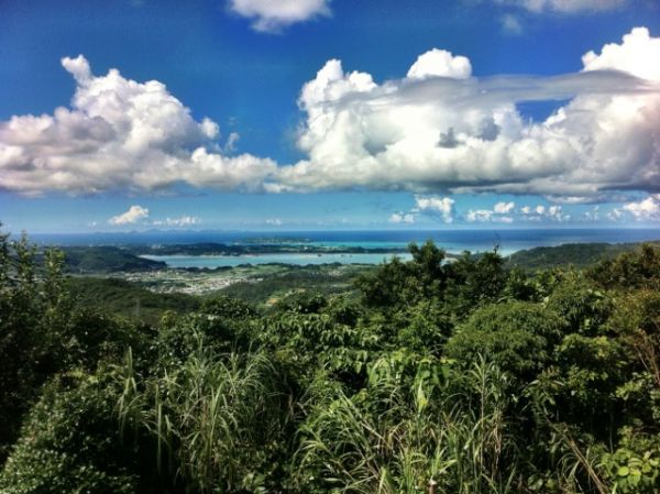
There are many forks in the trail since it is a massive network, but if you follow the signs the read 名護岳 “Nago-dake” or 名護山 “Nago-yama”, you will be fine. Expect a lot of pests along the route since most of the route is shaded under trees, but don’t let the shade fool you, it will be hot. Upon reaching the summit, roughly an hour and a half to two hours later, you get an almost 360 degree view of the Nago area. You will see both sides of the island, of course.

Nago Mt Signs
At the summit a long white pole marks the top along with another stone marker. You will also see the entrance to the other trail as well. Looking east, you can see Camp Schwab and the sea, looking west you can see Nago city, Kouri-jima and other nearby mountains.
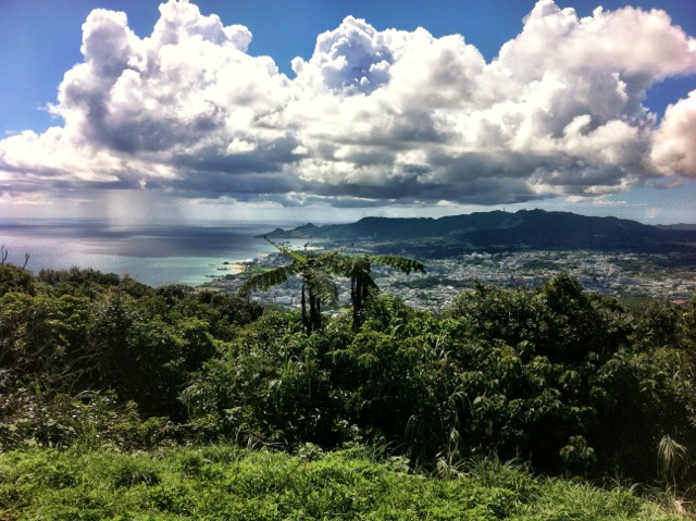
Nago Mt View 2

Directions: To reach this hike, drive north into Nago city via the Expressway or Highway 58. Upon entering the city you will see signs overhead for Nago Castle Park or Nago City Park, follow them to the roundabout with the tree and turn right. Across the street from the Orion Beer Factory is the South Entrance Parking lot. The North Entrance is found along Pref. Route 71.
Details: Bring lots of water, sunscreen, snacks and bug repellent. Even though kids from the camp hike the trail, I wouldn’t recommend it for kids under 7 due to it’s length. And start this hike early since there is no lighting along it.
HIked to the top today in perfect weather. We started at the lower parking and went through the Youth Center ignoring the Do Not Enter This Area sign. We eventually passed by a classroom full of students on our way to the camping area to begin the climb. Lots of stairs to get to this point and then lots more stairs to the summit. We summited in overcast, cool and mild wind conditions. We decided to descend via the normal route which was also fun passing the hiking clubs heading up.
Thanks for the info. I caught the 120 bus out of Naha to a nearby bus stop and hiked from the bottom. When you get to the park head to the nature trails marked “G” on the park maps. The summit is #9 on the trail. A great hike overall and loads of stairs!
Thanks once again for the information!
How long is the trail? Is it more than 3 hours?
Thanks!
Just hiked this in the heat of summer while 22 wks pregnant. Oh my goodness, lots of stairs! I’d suggest driving your car up to the parking lot further up the hill if you have kids. It’s a great hike with a great view, and you certainly get a workout!
I’m trying to plan a hiking/planning trip for me and some buddies. Was wondering if you could share any more info on the campgrounds there, and what the rules and regulations are for the area and if there is any equipment for rent nearby.
The campground is private property, mainly reserved for local kids. I’m not sure if they would let you stay there. I recommend asking your local outdoor rec or mwr folks for better suggestions on where to camp out.
Just hiked it this weekend! Hiked from the bottoms of the stairs, to the field/park, to the summit. Great hike, great view, great time!
Fantastic Post, now I just need to hop a plane back to hike that mountain!