CONTRIBUTED BY CASSANDRA ABEL
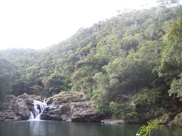
Tanaga View
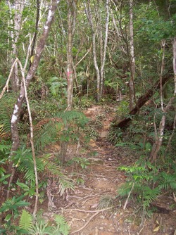
Tanaga Hike
On a trip up to Cape Hedo we found another small wonder of Okinawa called Tanaga-gumui (also called Aha Falls). If you are up that way and want to see more than just Cape Hedo, make a stop at Tanaga-gumui.
Tanaga-gumui is out of the way a bit and you will miss it if you’re not looking. Be prepared for a pretty intense hike as well! I didn’t know that it was going to be so far off the path and muddy and we were wearing uggs and flip flops; so it was much harder than it should have been.
You hike down a tiny trail on the side of the mountain, there is rope some of the way but mostly not, so be prepared to get dirty and slip a little bit. Once you finally make it all the way down to the bottom the view is breathtaking.
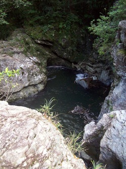
Tanaga Pool
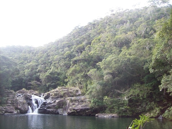
The first thing you will see is a beautiful waterfall in an enormous pool. There are little paths that lead to either side, one a little more rugged climbing over roots and rocks to get to a small waterfall and pool. The other way will lead you to the big waterfall but being that we weren’t wearing right footwear for this pit stop we didn’t climb that part.
Apparently Tanaga-gumui is a very deep pool that it’s a popular place for divers — although I couldn’t imagine hiking down with all that gear! There was also a rope hanging from a tree that it looks like people use often to swing into the pool. I can’t wait to venture back when the weather (and water!) warms up some.
If you decide to go, be prepared! Hiking shoes/sturdy sneakers are a must! Possibly a change of clothes and wet wipes for the ride home would be a smart idea. My 3 year old trekked down the mountain, so it is do-able for kids as long as they are willing to walk a bit. I don’t think carrying a small child would be a safe idea.
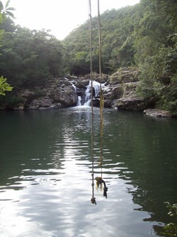
Tanaga Rope Falls
Tanaga-gumui (Aha Falls)
GPS Coordinates: 26.7255278, 128.2879167
Directions: Take the expressway up to nago. Follow 58 through Nago past the entrance to Okuma Resort. About 5.5 kilometers past Okuma Resort will be a sign for Route 2. Turn right onto route 2 and continue through the mountains until you reach route 70. Turn right onto route 70 and go about 3.5 kilometers until you see a sign for Tanaga-gumui. You can turn at the sign but we found that if you make your next right (after the sign) it’s closer to the trail.
If you decide to make a stop after Cape Hedo turn left on 58 and follow the road until it turns into 70. You will pass a route 2 sign don’t mind it, follow the road until you see another route 2 sign and it will be 3.5 kilometers on your right.


Permanently closed since the American’s death last year. Chain link gate over both entrances.
Thanks for the update.
So very sad. 😣
Is this open now or permanently shup?
Just drove by, the sign is taken down and both roads are chained off. Not sure if it’s a seasonal closure or permanent but a 3 hour drive for nothing. Heading to Hedo point instead.
Beautiful but I recommend to stay away from here, the vibes here are heavy and will affect you. Lots of bad has happened here.
Does anyone know if the rope is still there? I haven’t been up there for quite some time…
I was there on Sunday and the tree with the rope had fallen into the water 🙁
The map Pin above is incorrect. Here is the actual turnoff location: 26°43’31.9″N 128°17’16.5″E
Thank you for these updated coordinates, Keith. I’ve added them to the post and the map.
Gosh, this place is amazing. I went once and love it. I will be frequenting it during my time here in Okinawa. Love it.
As far as directions, the sign that you are looking for is a White road sign, and it says “Tanagagumuino.”
Also on the sign you will see “Ahano” and “Plant Mangvillages.” If you hit a small town then you’ve gone too far.
The place is a lot of fun, the water is pretty deep all around, it’s a really beautiful place and quite the experience.
To anyone that goes there, PLEASE clean up after yourself. There is entirely too much trash all over that place because people don’t care.
Can I take my dogs here? I have two dogs-German Shepperd and a boxer. I ‘d love to take them with us.
Any reply on if you can bring dogs!?
Bring your dogs. Others do.
Went there yesterday with the family. By far the best waterfall we’ve seen. Hike down was quick and easy. The pool area was huge and so much fun! We plan to go back with a bigger backpack and picnic lunch.
This is an AMAZING SPOT!!! directions were easy to follow, and i’ve been twice in the last two weeks 🙂 Some of the locals jumped on the rope swing to show us some of their tricks, and it was SUCH a blast!
Mai, From the Tanagaa-Gumui parking lot (just off Route 70, 1 km above Aha Village) — There is a sign over the road — it is only a 5-to-7 minute walk in. If it’s after a rain, some parts can be a bit slippery. Otherwise, the fairly well-made trail is at best an easy walking slope for half the way, and the rest is at a normal “stairs” angle. There are plenty of trees to hang onto as well. As you can read by others comments, compared to the longer trails and river-walks giving access to the other Falls on Okinawa, this is relatively quick, dry, and family friendly. The last time I was there, I saw a nursing mother with a nine-month old having lunch by the lake, with her 2-ear-old little girl splashing around in the shallows in front of her. Dad was diving off the rocks into the Lake on the far side. Have a nice day !
Hi! My friends and I are planning to go there today. I’m just wondering how difficult or easy the trek to the falls is? Is it comparable to Taa taki falls?
While researching on this place I found that another guy park near Tanaga-gumui Plant Community. Is it the same place you parked?
Hope you can help. Thanks in advance!
Hi D.L. I’m the “man surveying down there”. ^_^ A week after you were there, a young Japanese man let himself get swept over the lower falls. Some U.S. Marines who were there helped extract him, and he was eventually taken to a local hospital by Ambulance. A rare but scary event for sure ! Otherwise, most folks have no trouble there. You are the first pregnant women I’ve ever seen there, and that should prove to all how safe the access is, and how even a mama-san-to-be can sit in the shallows, enjoy the water, and have a nice break in the wilds of northern Okinawa ! Yesterday, (Saturday) 20 folks from my wife’s Church went up there to picnic and swim for the day. All had a fun and fantastic time, returning home safe and sound. Cheers !
i was one of marines that helped save the local. i was just wondering if you were the man who took pictures and if that was the case, could you send those to me? if you happen to be that man, reply to get my email
We went to Aha falls today and it was great! I just want to add one comment about the directions. Instead of heading 3.5 km along Rte 70, it’s actually 2.3 km (we set the odometer to ensure we didn’t miss any unmarked turns)…if you go 3.5km you’ll go all the way into Aha town, a little too far! The parking area is really incognito too, you’ll know you’re in the right spot because there’s a little sub station emergency siren thingy in the lot. We ran into a man surveying down there and he said the trail has been recently re-done and he was spray painting all the tripping hazards in the trail red. The trail isn’t bad at all as far as difficulty. I’m 8 months pregnant and had no problems waddling my way down to the water and didn’t even come close to slipping 🙂 Enjoy!
Definitely a must-go-to outdoor adventure. The waterfall is not huge (25ft or so), but it falls into a pool that is roughly the size of an olympic swimming pool. There are a few places to jump off of the rocks that are anywhere from 5-15ft high, but YOU MUST CHECK THE DEPTH before jumping. There are rocks beneath if you don’t get it right. Even with the rocks you have at least 8 feet in most places, but near the actual falls there are rocks 4-5 feet below the surface. The water is not clear (but it is clean), so you have to physically check by getting in the water and plunging down feet first. It was a blast. The rope is pretty cool too.
-Alternate directions: From 329 heading north past Camp Schwab turn right onto Hwy 331. Go through the tunnel and stay on 331 for about 30-45 minutes. The highway will split into Hwy 331 and Hwy 70. Stay on Hwy 70. At mile marker 19.9(I think) there is a small road on the left that goes to the waterfall parking lot. About 300m further up around the bend in the road you will see a sign that reads Tanagagumui or something like that. It’s hard to miss. That marks the main entrance road to the falls parking lot (much worse road though). If you see the turn off to Hwy 2 going West then you went about 3.5km too far. If you want to hike for a bit, there is another pool and waterfall similar to main one about 200m downstream. The trail is rough at best and non-existent at times so be very careful.
I wish this location was on the “I’m the Map” 🙂